ܠܦܦܐ:Map - NL - Municipality code 0164 (2009).svg

Size of this PNG preview of this SVG file: 300 × 160 ܦܩܣܠ. Other resolutions: 320 × 171 ܦܩܣܠ | 640 × 341 ܦܩܣܠ | 1,024 × 546 ܦܩܣܠ | 1,280 × 683 ܦܩܣܠ | 2,560 × 1,365 ܦܩܣܠ.
ܠܦܦܐ ܫܪܫܝܐ (SVG file, nominally 300 × 160 pixels, file size: 530 KB)
| Description |
|
|||
| ܣܝܩܘܡܐ | ||||
| ܡܒܘܥܐ | own work , using CBS data | |||
| ܣܝܘܡܐ | Michiel1972 (talk) 21:52, 24 January 2009 (UTC) | |||
| Permission (Reusing this file) |
Attribution ShareAlike 3.0 |

.svg)
This file is licensed under the Creative Commons Attribution-Share Alike 3.0 Unported license.
- You are free:
- to share – to copy, distribute and transmit the work
- to remix – to adapt the work
- Under the following conditions:
- attribution – You must give appropriate credit, provide a link to the license, and indicate if changes were made. You may do so in any reasonable manner, but not in any way that suggests the licensor endorses you or your use.
- share alike – If you remix, transform, or build upon the material, you must distribute your contributions under the same or compatible license as the original.
ܬܫܥܝܬܐ ܕܠܦܦܐ
Click on a date/time to view the file as it appeared at that time.
| ܣܝܩܘܡܐ/ܙܒܢܐ | ܨܘܪܬܐ ܙܥܘܪܬܐ | ܩܝܡ̈ܐ | ܡܦܠܚܢܐ | ܥܘܩܒܐ | |
|---|---|---|---|---|---|
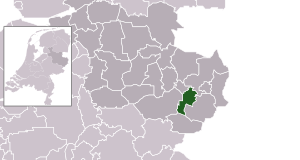
| ܗܫܝܐ | 21:52, 24 ܒܟܢܘܢ ܐܚܪܝ 2009 | | 300 × 160 (530 KB) | Michiel1972 | {{Information |Description=*Location maps for the 441 municipalities in the Netherlands. Boundaries 1/1/2009 *Automatically generated with script *File name contains "Municipality code" (CBS-code) as specified in: [http://www.cbs.nl/nl-NL/menu/methoden/c |
ܡܦܠܚܬܐ ܕܠܦܦܐ
ܦܐܬܐ ܗܕܐ ܐܣܪ ܥܡ ܗܢܐ ܠܦܦܐ:
ܡܦܠܚܢܘܬܐ ܓܘܢܝܬܐ ܕܠܦܦܐ
The following other wikis use this file:
- Usage on ar.wikipedia.org
- Usage on en.wikipedia.org
- Usage on fa.wikipedia.org
- Usage on fr.wikipedia.org
- Usage on hr.wikipedia.org
- Usage on hu.wikipedia.org
- Usage on hy.wikipedia.org
- Usage on id.wikipedia.org
- Usage on it.wikipedia.org
- Usage on ko.wikipedia.org
- Usage on la.wikipedia.org
- Usage on ms.wikipedia.org
- Usage on nl.wikipedia.org
- Usage on ru.wikipedia.org
- Usage on tr.wikipedia.org
- Usage on uk.wikipedia.org
- Usage on ur.wikipedia.org
- Usage on zh-min-nan.wikipedia.org
- Usage on zh.wikipedia.org
.svg)